


Corsica's mountains are everywhere. Its 1,000 km of deeply indented rocky coastline and long sandy beaches are set against more than 120 peaks over 2,000 metres high. The succession of large western gulfs, with their steeply-sloping valleys often blocked by deep gorges, presents a surprising contrast with the other islands of the Mediterranean. Hiking in Corsica is an ideal way to discover these valleys, which are sometimes only accessible on foot, and to explore the rich diversity of its landscapes and ecosystems.


The Gravona is a river in southern Corsica that rises on the western flank of Monte Renoso and flows into the Prunelli 46 km further on. The road linking Ajaccio to Bastia via the Col de Vizzavona and the Corsican railway line pass through the Gravona valley. Just thirty or so kilometres from Ajaccio and forty or so from Corte, the Haute Vallée de la Gravona is the ideal destination for a family break away from the crowds and mass tourism of the seaside resorts.
Some walks to do in the valley


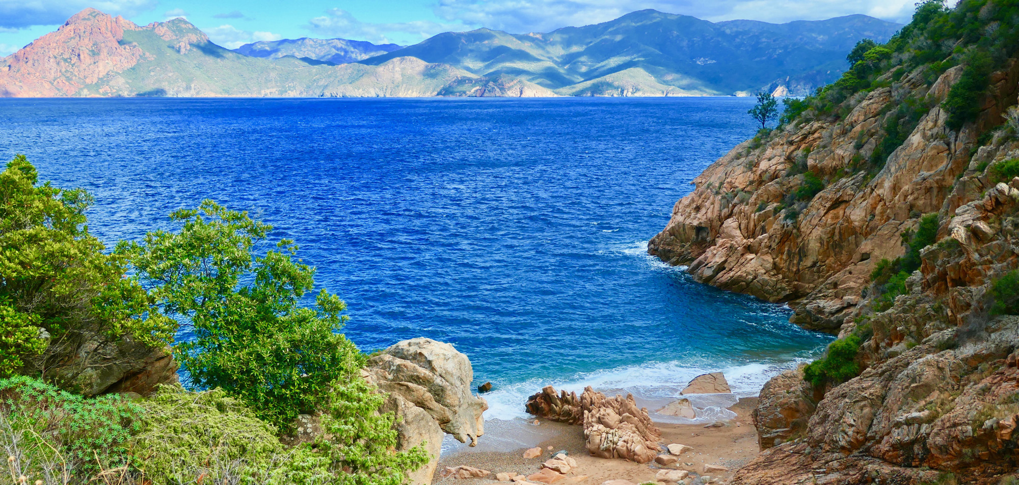
Located in the Balagne region of north-west Corsica, the magnificent Fango Valley is the valley of the river Fango, also known as the Falasorma or Filosorma. The river rises at the foot of Capu Tafunatu (2335m) and flows into the sea in the Gulf of Galéria. Accessible in less than 45 minutes by car from Calvi, a small road leads up the valley along the river for around 15km.
As you enter this hinterland, you'll discover a fertile region often referred to as "the garden of Corsica". Classified as a UNESCO biosphere reserve in 1977, the Fango valley is famous for its crystal-clear waters and natural pools. At the heart of Corsican nature, the Fango Reserve encompasses majestic oak forests at altitudes of up to 2,556 metres at the foot of the northern slopes of the Paglia Orba massif.
Careful hikers are sure to come across a wide variety of birds. More than forty species nest in the Fango valley. In the higher levels of this Mediterranean valley, Corsican mouflon, bearded vultures and golden eagles occupy the steep relief of the high peaks.
Some walks in the valley


Comprising the communes of Castifao, Moltifao and Asco, the Asco Valley is one of the many valleys you can explore by car. It can be reached from Ponte-Leccia via a winding, very narrow road. Situated in the Corsican Regional Nature Park, its territory covers the entire course of the river Asco.
In its lower reaches, the valley is still wide and flat, but after Moltifao and for almost 9 km, the road winds through a narrow gorge to cross the magnificent Asco gorges. The Asco valley is very popular with hikers, who can climb to an altitude of over 2,000 metres, where there is still a population of moufflons.
In addition to the many magnificent natural pools, there is a beautiful via ferrata and an adventure park. During the winter season, you can also ski in the Asco valley at Ascu Stagnu.
Some walks in the valley


Rising from Lake Nino at an altitude of over 1700m, the Tavignano is the longest river in Corsica after the Golo. Access to the Tavignano valley is via an old mule track that winds from Corte up to Lake Nino at its highest point. Between Corte and the Sega refuge, the trail uses a section of the Mare a Mare Nord.
Situated in the heart of the Regional Nature Park, the Tavignano valley is one of the most beautiful and best-preserved valleys in Corsica. For those wishing to swim along the way, there are several places offering access to the river and its refreshing natural pools. In summer, it is advisable to set off early, as there is very little shade on the south-facing path.
Some walks in the valley


From Corte, a narrow, winding road leads into the Restonica Valley. This road follows the Restonica river for 20 km to reach the Grotelle sheepfolds at an altitude of 1,370 m. Classified as a "Grand Site" during the summer months, the Restonica Valley is one of the island's most popular natural attractions.
Home to the large high-altitude glacial lakes of Melo 1711 m and Capitello 1930 m, this valley offers access to the high mountains via the GR20 trail up to Monte Rotondo (2622 m). There are plenty of wonderful places to swim in the clear waters of its natural pools, as well as numerous climbing sites.
Some walks in the valley


Situated in the central north of the island, the Niolu valley is a high mountain region. The Golo, Corsica's longest river, originates in the Niolu. Casamaccioli, Corscia, Calacuccia, Lozzi and Albertacce are the main villages in this valley.
A remote part of the island's interior, this wide valley is accessible either from the Gulf of Porto, via the Vergio pass (the island's highest road pass), or from Corte, via the spectacular Scala di Santa Regina. Corsica's least populated region boasts some of the highest peaks, including Capu Tafunatu (2335m), Paglia Orba (2525m) and Monte Cintu (2709m), the island's highest peak.
A heavily wooded micro-region, the Niolu is covered by vast forests, including the Valdu Niellu with its magnificent Larici pines. Niolu is also famous for being the site of Corsica's largest religious pilgrimage, the famous "Santa di Niolu" on 8 September each year.
Some walks in the valley